
- Home
- Getting Started
- Documentation
- Proxy/Firewall
- Tour the Interface
- Tour the Layers
- JMARS Video Tutorials
- Lat/Lon Grid Layer
- Map Scalebar
- Nomenclature
- Crater Counting
- 3D
- Shape Layer
- Mosaics
- Map
- Advanced/Custom Maps
- Graphic/Numeric Maps
- Custom Map Sharing
- Stamp
- THEMIS
- MOC
- Viking
- CTX
- HiRise
- HiRISE Anaglyph
- HiRISE DTM
- HRSC
- CRISM Stamp Layer
- OMEGA
- Region of Interest
- TES
- THEMIS Planning
- Investigate Layer
- Landing Site Layer
- Tutorials
- Video Tutorials
- Displaying the Main View in 3D
- Finding THEMIS Observation Opportunities
- Submitting a THEMIS Region of Interest
- Loading a Custom Map
- Viewing TES Data in JMARS
- Using the Shape Layer
- Shape Layer: Intersect, Merge, and Subtract polygons from each other
- Shape Layer: Ellipse Drawing
- Shape Layer: Selecting a non-default column for circle-radius
- Shape Layer: Selecting a non-default column for fill-color
- Shape Layer: Add a Map Sampling Column
- Shape Layer: Adding a new color column based on the values of a radius column
- Shape Layer: Using Expressions
- Using JMARS for MSIP
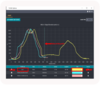
- Introduction to SHARAD Radargrams
- Creating Numeric Maps
- JMARS Shortcut Keys
- JMARS Data Submission
- FAQ
- Open Source
- References
- Social Media
- Podcasts/Demos
- Download JMARS
Welcome to the JMARS website
JMARS is an acronym that stands for Java Mission-planning and Analysis for Remote Sensing. It is a geospatial information system (GIS) developed by ASU's Mars Space Flight Facility to provide mission planning and data-analysis tools to NASA scientists, instrument team members, students of all ages and the general public. JMARS has been available to the public since 2003. It is used in over 100 countries and has over 6,000 active users.
JMARS Announcements
-
Come talk to JMARS Developers and ask any questions you may have!
-
2024/04/09 - JMARS release 5.4.2.1
In the latest JMARS release (version 5.4.2.1), we have prioritized enhancing the user experience by implementing interface improvements based on user feedback. Additionally, we have addressed important bug fixes to ensure data accuracy and reliability.
-
In the latest JMARS updates, ellipse drawing now supports importing ellipses from files without paths, simplifying creation processes. Additionally, Phase 2 of the Profiles introduces interface enhancements such as comprehensive coordinate views and the ability to perform point editing while using Profile Manager. Profile reversal is now available directly from the Chart viewer, streamlining profiling workflows.
JMARS Features

Information
Weekly Virtual Office Hours
Have any questions? On Friday May, 10th @12pm MST, Come join us for office hours on Zoom to learn and ask any questions you might have! Click Here for more information
Looking for an Education Resource site that uses JMARS? Click Here
Login
JMARS Public Downloads
|
|
The following JMARS installer is likely the best for your system: This JMARS installation includes several planetary bodies, such as Mars, Earth, Earth's moon, Mercury, Venus and many more Need help? Instructions on installation are below. |
|
|
The following JMARS 2035 installer is likely the best for your system: JMARS 2035 Website and Video Tutorials |
|
|
The following JMARS MSIP installer is likely the best for your system: This is the JMARS MSIP version of JMARS for the Mars Education Program. |
|
|
The following J-Earth installer is likely the best for your system: |
|
|
The following J-Vesta installer is likely the best for your system: |
|
|
The following J-Ceres installer is likely the best for your system: |


Instructions for Installing JMARS: Windows | MacOS | Linux
Video Instructions for Installing JMARS: Windows | MacOS | Linux
Installers powered by: 

Automated Testing Supported by: 