- Home
- Getting Started
- Documentation
- Release Notes
- Tour the Interface
- Tour the Layers
- JMARS Video Tutorials
- Lat/Lon Grid Layer
- Map Scalebar
- Nomenclature
- Crater Counting
- 3D
- Shape Layer
- Mosaics
- Map
- Advanced/Custom Maps
- Graphic/Numeric Maps
- Custom Map Sharing
- Stamp
- THEMIS
- MOC
- Viking
- CRISM Stamp Layer
- CTX
- HiRise
- HiRISE Anaglyph
- HiRISE DTM
- HRSC
- OMEGA
- Region of Interest
- TES
- THEMIS Planning
- Investigate Layer
- Landing Site Layer
- Tutorials
- Video Tutorials
- Displaying the Main View in 3D
- Finding THEMIS Observation Opportunities
- Submitting a THEMIS Region of Interest
- Loading a Custom Map
- Viewing TES Data in JMARS
- Using the Shape Layer
- Shape Layer: Intersect, Merge, and Subtract polygons from each other
- Shape Layer: Ellipse Drawing
- Shape Layer: Selecting a non-default column for circle-radius
- Shape Layer: Selecting a non-default column for fill-color
- Shape Layer: Add a Map Sampling Column
- Shape Layer: Adding a new color column based on the values of a radius column
- Shape Layer: Using Expressions
- Using JMARS for MSIP
- Introduction to SHARAD Radargrams
- Creating Numeric Maps
- Proxy/Firewall
- JMARS Shortcut Keys
- JMARS Data Submission
- FAQ
- Open Source
- References
- Social Media
- Podcasts/Demos
- Download JMARS
Pixel Export
Pixel Export is a tool that allows you to export the pixel values under a line, point or polygon for the map of your choice into a csv file. You can export pixel values for stamps and/or maps. The tool also allows the user to export the pixel values for more than one map at a time as long as the ppd is the same for each map. Below is a short tutorial on how to use the tool.
How to Export Pixels:
- Add a polygon, point or line to your main view. This is the desired area that you would like to have the pixel data for.
- Right click --> Select Feature and select the shape that you would like. The shape will be outlined in yellow when it is selected.
- Right click the screen --> Polygon Functions --> Export Pixels Data for Polygon
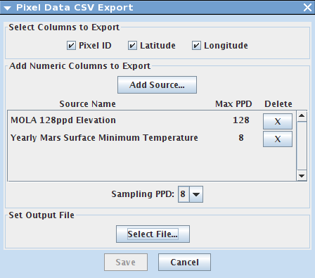
- The Pixel Data CSV Export dialog box will open and there are many options to chose from.
- Select Columns to Export: Select the boxes you would like to export per pixel. Default option is to export Pixel ID, Latitude, Longitude for each pixel.
- Add Numeric Columns to Export: Add the map you would like to export pixel data for. Click "Add Source..."
- Multiple maps can be exported at one time. This will add all of your data to one csv, separated by column.
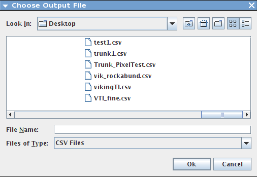
- When all of the maps are added and the ppd is selected, click "Select File" to name your csv and to select a location to save it to. When ready, click the "save" button to finish the process.
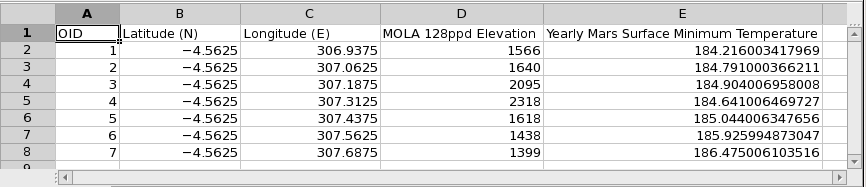
- An example of a saved csv file export is below. Here, the Pixel ID, Latitude, Longitude, Mola Elevation, and the yearly Mars surface temperature (min) were exported per pixel.