 |
JMARS Video Tutorials |
Learn JMARS 5 through Video Tutorials! Step by step instructions to using JMARS 5 |
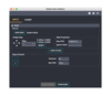 |
Focus Panel: Settings Feature |
In the focus panel, you can access the M,P and opacity through the "Settings" button. |
 |
Creating a Threshold/Mask on Numeric Maps |
Learn how to create your own threshold layers with numeric maps. |
 |
Lat/Lon Grid Layer |
The Latitude/Longitude Grid Layer, which is available in all releases of JMARS, draws latitude and longitude lines in the Viewing Window and allows users to measure distances. |
 |
Import a raster into QGIS from JMARS |
Learn how to export a tiff in JMARS and bring it into QGIS. Also, learn how to georeference the image in QGIS. |
|
|
JMARS Preferences Window |
This tutorial will show you how to navigate and use the Preferences options effectively. |
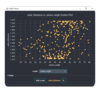 |
Scatterplots with stamps |
You can create scatter plots using stamps! |
 |
Resize to show global view |
Resize your mainview to show the entire body's surface. This tutorial goes over how to resize your mainview to show the entire body from 0-360 or -180 to 180. |
 |
Searching for Landmarks |
There is a new search functionality in the lon/lat box that allows users to search for landmarks. Don't know where the landmark location is but you know the name of it? Use this search function to locate it! |
 |
Map Scalebar Layer |
The Map Scalebar Layer, which is available in all releases of JMARS, displays a scalebar in the Main View that automatically shows the correct scale for the map being viewed. |
 |
Shape Layer |
The Shape Layer allows users to create and view files containing points, lines, polygons, circles and ellipses. This tutorial will go over how to draw, load, and save shapes. It will also show how to use the scripts functionality in order to change one or more shapes at once using SQL-type commands. |
 |
Introduction to Ellipse Drawings |
Learn how to draw and edit ellipses. This is different from drawing a 5 point ellipse. This tutorial will show you how to use the ellipse drawing feature. |
 |
Landmark Searching Tool |
Learn how to find landmarks with the landmark searching tool. It's easy and fast! |
 |
Draw profile lines using numeric data sources |
Draw profile lines using numeric data. |
 |
Nomenclature Layer |
The Nomenclature Layer displays the names and locations of all the named features on Mars. This data has been provided by the U.S. Geological Survey's Astrogeology Research Program. The Nomenclature Layer is available in all JMARS releases. |
|
|
Create a numeric map from JMARS in ArcGIS |
Learn how to use JMARS and ArcGIS to create a numeric map. This tutorial will demonstrate how to export pixel values from JMARS, bring that data into ArcGIS and then create a numeric map. |
 |
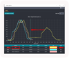
Info Panel Updates |
The info panel has been redesigned. Learn how where the info panel is now and how it's changed. |
|
|
Crater Counting Layer |
The Crater Counting Layer allows users to mark craters and then output the locations, diameters and other associated data to shape files in various formats. This data can then be used for regional-scale studies or combined with similar data from multiple users to enable global-scale crater studies. |
 |
Can't see your files in JMARS? Learn how to get access here. |
Are you using a Mac and you can't see your files in JMARS? Newer Mac OS versions require you give Full Disk Access to apps. This tutorial will show you how to give Full Disk Access to JMARS. |
 |
3D Layer |
The 3D Layer is unlike many of the JMARS layers because it does not load any visual data into the Viewing Window. Instead, it opens a new window and displays a three-dimensional version of the scene in the Main View. |
|
|
3D Layer Updates (version 5.3.0 and up) |
The 3D Layer is unlike many of the JMARS layers because it does not load any visual data into the Viewing Window. Instead, it opens a new window and displays a three-dimensional version of the scene in the Main View. |
 |
Mosaics Layer |
The Mosaics Layer allows users to view regional image mosaics in JMARS. The only mosaics currently available are THEMIS VIS, Day IR and Night IR mosaics, but this will be expanded to include mosaics from other instruments as they become available. Most were originally compiled as part of the various research projects at the Mars Space Flight Facility and are now being made available to a wider audience through JMARS. The Mosaics Layer is avaialble in the Public, THEMIS and MRO releases of JMARS. |
 |
Map Layer |
The Map Layer allows users to load and display global maps of Mars and other planetary bodies. All versions of JMARS include the Map Layer, which offers users two options: Graphic/Numeric Maps and Advanced/Custom Maps. |
 |
Using the formula field: Custom Shape Layer |
Want to create a new column in your shape file with a calculation? Use this tutorial to learn the basics to formula fields. |
 |
Using the formula field: Stamp Layer |
Learn how to add a calculation to different fields in the stamp layer. |
|
|
Advanced formula field: Stamp Layer |
Calculating formula fields in the stamp layer using advanced calculations |
 |
Advanced/Custom Maps |
The Advanced/Custom Maps Layer allows users to configure a given map and also allows a user to load custom-built maps into JMARS. Once loaded, these maps can be used in conjunction with other JMARS layers (ie: Stamp Layer, ROI Layer, etc) as if they were one of the default JMARS maps. |
|
|
New Custom Map Interface |
The Maps Layer allows users to configure a given map and also allows a user to load custom-built maps into JMARS. Once loaded, these maps can be used in conjunction with other JMARS layers (ie: Stamp Layer, ROI Layer, etc) as if they were one of the default JMARS maps. |
|
|
Custom Map Sharing |
Custom map sharing allows users to share custom maps with users and groups. Group administration allows users to add/update/delete groups and manage group membership. |
 |
Stamp Layer |
The Stamp Layer displays the outlines of observations made by various orbital instruments. Users can see where observations have been acquired and then load only those they wish to view, which is much faster than attempting to load all observations from a given instrument. |
